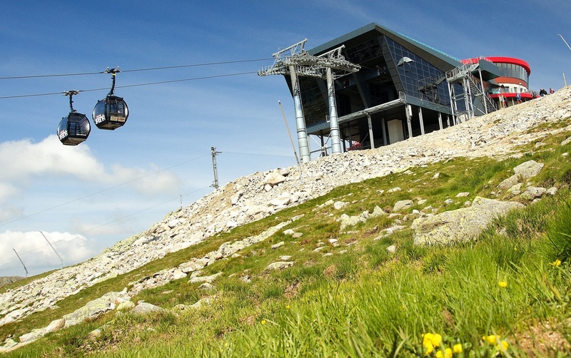
Jasná cable car tickets are available
at the best prices online on gopass.travel
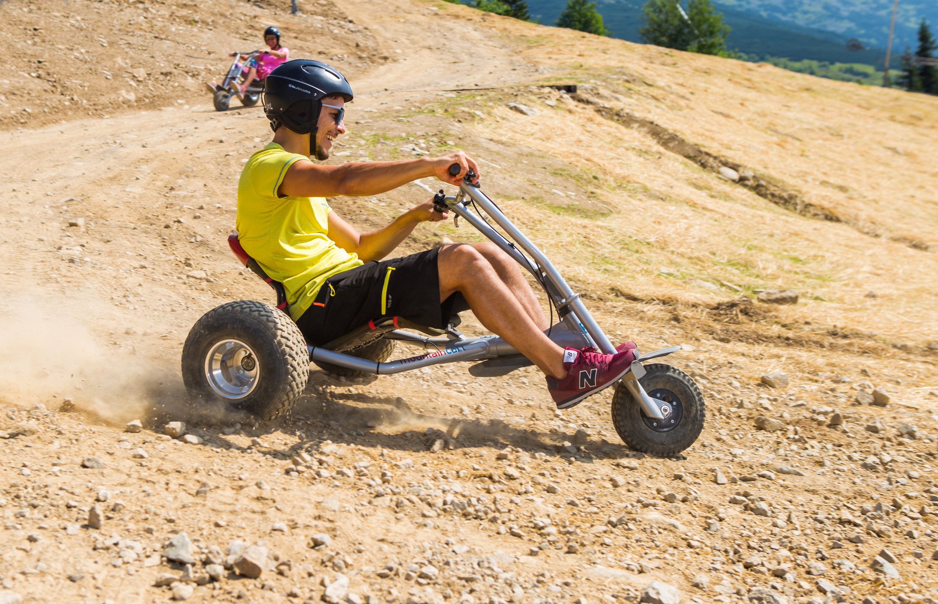
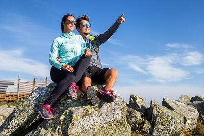
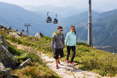
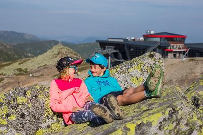
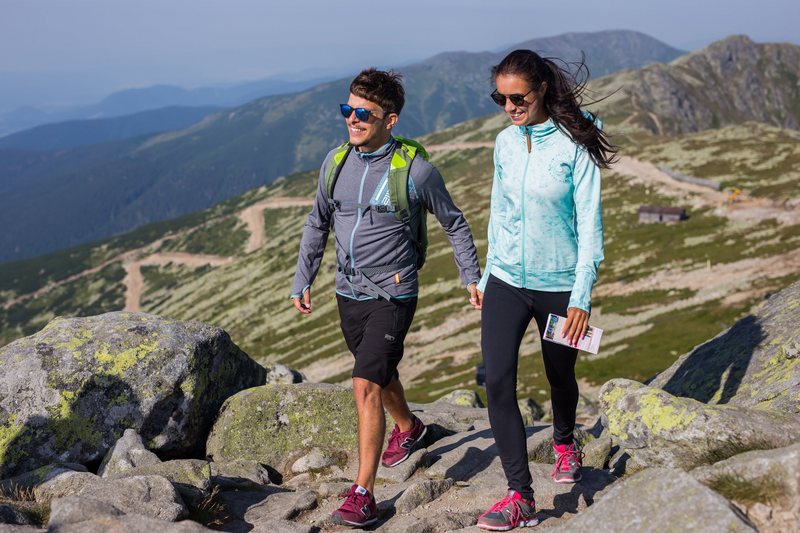
Take this opportunity and use cableways though the school holidays have come to an end. Hence all age groups can enjoy the beautiful views. Colourful nature and a colourful offer of services are waiting only for you!

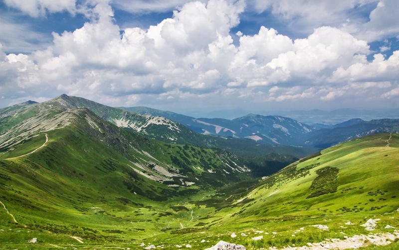
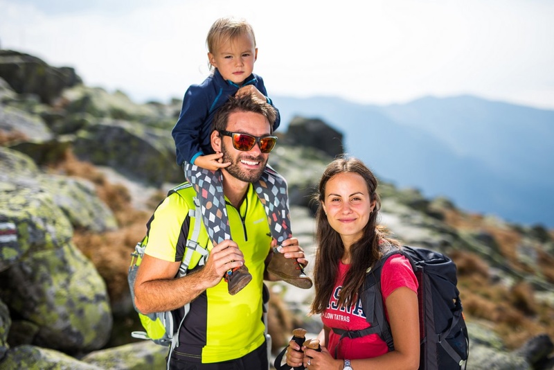
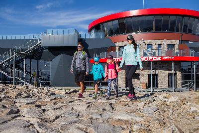
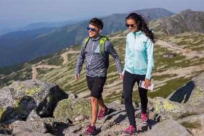
Jasná Nízke Tatry offers numerous trails for hiking and trekking different difficulty, from difficult, which requires a certain degree of preparation to those that are suitable for families with children or beginners. Choose according to your physical condition and in case you don’t feel in the mountains like at home use the services of the mountain guides, thanks to whom your activities in the mountains become safe adventure. We are offering you one day easier hiking tracks or multi days intermediate and difficult mountain tracks.
If you are inspired by our offer and accept the invitation to the world of silence you can discover a wonderful gift which the nature gave to Demänovska valley and Low Tatras.
at the best prices online on gopass.travel
1. UP THE HIGHEST PEAK OF THE LOW TATRAS – MT ĎUMBIER AND BACK
Trail length: 8.8 km
Time: 4 hrs
Difficulty: Medium
It´s an easier mountain ridge hike up the highest peak of the Low Tatras. The peak of Ďumbier offers an extensive circular view of almost all mountain ranges of Central and North Slovakia.
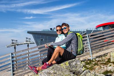
Start and Finish: Alighting station of Funitel at Mt Chopok 2,004 m asl.
Route: take the red hiking trail alongside the cottage of Kamenná Chata, through the sadle of Demänovské Sedlo and the grassy upland of Krúpová Hoľa up to the peak of Ďumbier 2,043 m asl. The same route is leading back to Mt Chopok.
2. FROM MT CHOPOK THROUGH THE SADDLE OF POĽANY TOWARDS TRI VODY AND BIELA PÚŤ
Trail length: 9.1 km
Time - trail 2: 3 hrs 20 min
Time - trail 2a: 4 hrs
Difficulty: Easy
It´s an easier mountain ridge hike and descent to Jasná with beautiful views of the massive of Skalka, water reservoir of Liptovská Mara and the Low Tatras valleys.
Start: alighting station of the Funitel cable car at Chopok 2,004 m asl.
Finish point: Biela Púť 1,117 m asl.
Route description: take the red trail through Dereše up to the saddle of Poľana. Turn right in the saddle to get to the yellow touristic trail leading to Tri Vody and continue along the yellow trail to the cottage of Mikulášska Chata alongside the mountain tarn of Vrbické Pleso up to the Wellness Hotel Grand Jasná and Biela Púť.
Alternative trail 2a: Take the red hiking trail at Tri Vody leading to Brhliská; beneath the rock of Orlia Skala turn to the blue hiking trail leading to Otupné and continue up to Biela Púť.
3. FROM MT CHOPOK UP TO THE SADDLE OF DEMÄNOVSKÉ SEDLO AND THROUGH THE VALLEY OF ŠIROKÁ DOLINA TO LÚČKY
Trail length: 9.5 km
Time - trail 3: 3 hrs
Time - trail 3a: 3 hrs 45 min
Difficulty: Easy
It´s an easier hike through the valley of Široká Dolina with a view of northern couloirs of Mt Chopok and Ďumbier.
Start: alighting station of the Funitel cable car at Chopok 2,004 m asl.
Finish point: Lúčky, bus stop
Route description: Take the red trail running alongside the cottage of Kamenná Chata and along the ridge up to the saddle of Demänovské Sedlo, where it is necessary to turn left towards the yellow hiking trail. After approximately 20 minutes turn left towards the green hiking trail and continue through the valley of Široká Dolina alongside the stream Demänovka up to Lúčky.
Alternative Trail 3a: Through Mt Tanečnica and the saddle of Javorie: from the saddle of Demänovské Sedlo take the yellow trail and continue along the side ridge through Mt Tanečnica, up to the saddle of Javorie. Turn left and take the red trail leading you to the green hiking trail. Continue along the green trail up to Lúčky. (+1 km, 45 min.).
4. EDUCATION PATH DEMÄNOVSKÁ VALLEY
Trail length: 13 km
Time: 4 hrs 30 min
Difficulty: Medium
Route: It´s a medium hiking trail, which follows an education path in Demänovská Valley with 12 information boards. It´s one of the nicest trails in the Low Tatras.
Start: Wellness Hotel Grand Jasná, car park
Finish point: Lúčky, bus stop
Education path: The path starts behind the Wellness Hotel Grand Jasná where the first education board is situated. The trail continues alongside the tarn of Vrbické Pleso and the coattage of Mikulášska Chata towards Otupné and Tri Vody. Turn left and take the red hiking trail running to Brhliská beneath the rock of Orlia Skala ascending up to Luková. Later the path descends up to Pekná Vyhliadka and traverses towards the cross-road in the valley of Široká Dolina. Continue left along the green trail up to Lúčky.
5. TO THE SYMBOLIC CEMETERY, THE DEMÄNOVSKÁ CAVE OF LIBERTY AND BACK
Trail length: 5: 1.8 km
Time- trail: 5: 50 min
Trail length 5a: 5.2 km
Time- trail 5a: 120 min.
Difficulty: Medium
Route description: An easy walk along the yellow hiking trail from Biela Púť alongside the Hotel Ostredok and an observatory tower offering an amazing view of the ridge and Demänovská Valley will lead you to the Symbolic Cemetery for Victims of the Low Tatras. Use the same way to get back.
Alternative Trail 5a: It is possible to take a long way round along the yellow hiking trail (+2.6 km,+1 hrs.) which will lead you to the Demänovská Cave of Liberty. Take the same trail to get back to the Symbolic Cemetery.
6. A WALK AROUND THE TARN OF VRBICKÉ PLESO
Trail length: 1 km
Time: 20 min
Difficulty: Easy
Vrbické pleso is a glacier tarn and the largest natural lake in the Low Tatras. It´s situated at an altitude of 1,113 m asl., in the upper western part of Demänovská Valley. It occupies an area of 0.69 ha, having 8 m maximal depth, 115 m length and 62 m width. It´s a moraine-dammed lake, which came into existence after the decline of glacier on the southern hills of Mt Chopok and Dereše.
Route description: A path is leading from the parking place behind the Wellness Hotel Grand Jasná up to Vrbické Pleso. On the right side of the lake an educational path was created with information boards. This path will leads you to Tri Vody. You can take a rest at the tarn, sitting on a bench, enjoying the silent of the forest and admiring the views of surrounding ridges of the Low Tatras.
7. ALONG THE RIDGE HIKING TRAIL “MAGISTRÁLA” FROM KOSODREVINA TO MT ĎUMBIER, UP TO MT CHOPOK AND BACK
Trail length: 10 km
Time- trail 7: 5 hrs 30 min
Time- trail 7a: 6 hrs 10 min
Time- trail 7b: 6 hrs 20 min
Difficulty: Medium
A hike medium hiking trail with views of the highest peaks of the Low Tatras
Start and finish: Kosodrevina Restaurant, 1,494 m asl.
Route description: along the blue hiking trail above Kosodrevina go right towards the cross-road of the saddle of Krúpove Sedlo, and then turn left to take the trail which will lead you up to the saddle. Here turn left and continue up to Mt Chopok along the red trail. Use the yellow trail to get from Mt Chopok to Kosodrevina.
Alternative roads:
7a: From the cross-road of the saddle of Krúpove Sedlo it is possible to take a long way round to the cottage of Chata Generála M. R. Štefánika (+40 min.).
7b: From Krúpova Hoľa it is possible to take a long way round and climb the Mt Ďumbier (+50 min).
8. FROM KOSODREVINA TO MT CHOPOK AND BACK
Trail length: 3 km
Time: 3 hrs 30 min
Difficulty: Medium
Hiking to the second highest peak of Low Tatras – Mt Chopok. Just under the peak, there is situated a mountain cottage of Kamenná Chata with a restaurant.
Start and finish: Kosodrevina Restaurant 1,494 m asl.
Route description: Get off the cable car and take a path above the Restaurant Kosodrevina. Turn left to get to the yellow trail and continue approximately 10 minutes to the cross-road. Then turn right and continue along the yellow trail up to Mt Chopok. You can use the yellow trail for your way back.
9. FROM KOSODREVINA TO THE COTTAGE OF CHATA M. R. ŠTEFÁNIKA AND TO TRANGOŠKA
Trail length: 9 km
Time: 2 hrs 40 min
Difficulty: Easy
It is an easy hike along the southern hiking trail with a view of the highest peak of the Low Tatras, and with a visit of an alpine cottage.
Start: Kosodrevina Restaurant 1,494 m asl.
Finish point: Trangoška – car park
Route description: From the path above the Restaurant Kosodrevina turn right and take the blue trail, which will lead you to the cottage of Chata M. R. Štefánika. From the cottage follow the green trail leading you to a car park at Trangoška.
10. FROM KOSODREVINA UP TO MT CHOPOK THROUGH THE SADDLE OF PRÍSLOP, MT DEREŠE AND BACK
Trail length: 6.5 km
Time: 4 hrs
Difficulty: Medium
Start and finish: Kosodrevina Restaurant 1,494 m asl.
Route description: From the path above the Restaurant Kosodrevina turn left and take the blue trail up to the saddle of Príslop. Then turn right to the yellow trail and climb up to the mountain ridge. On the ridge turn right to the red trail which will lead you to Mt Chopok. Use the yellow trail for your way down to Kosodrevina.
11. FROM KOSODREVINA UP TO MT CHOPOK THROUGH THE SADDLE OF KRÍŽSKE SEDLO AND BACK
Trail length: 14 km
Time: 5 hrs 30 min
Difficulty: Difficult
It is a more difficult track offering the most stunning view of the massive of Skalky Massive and the valley of Vajskovská Dolina.
Start and finish: Kosodrevina Restaurant, 1,494 m asl.
Route description: From the path above the Restaurant Kosodrevina turn left and continue along the blue hiking trail to the saddle of Krížske Sedlo. In the Saddle turn right to the red trail which will lead you along the ridge to Mt Chopok. Use the yellow trail for your way down to Kosodrevina.
12. ALONG THE HUNTER´S PATH TO THE DEAD BATS´ CAVE
Trail length: 8.8 km
Time: 2 hrs
Difficulty: Difficult
Start: Kosodrevina, 1,494 m asl.
Finish point: Dead Bats´ Cave, 1,750 m asl.
Route description: After getting off a cable car at Kosodrevina take the blue trail leading to the cottage of Chata M. R. Štefánika and after 700m turn right to a forest path – the yellow trail – running through the forest. Then it´s connected to the green trail leading through the valley of Trangoška and to the cottage of Chata M. R. Štefánika. Continue along the green trail until the cross-road marker appears where you need to turn right to the Dead Bats´ Cave, which can be seen from the trail. Use the same trail for your way back or you can decline through the valley of Trangoška. From the cave it is possible to continue to the cottage of Chata M. R. Štefánika or up to the peak of Ďumbier and along the ridge up to Mt Chopok.